AgroVision AI
Spatiotemporal Deep Learning for Large-Scale Crop Mapping and Food Security Assessment
The Challenge of Food Security at Global Scale
Ensuring food security requires accurate, real-time knowledge of what crops are planted where, at scale. However, relying on manual agricultural surveys is slow, expensive, and scales poorly across vast continents.
AgroVision leverages the powerful combination of Spatiotemporal Deep Learning and Earth Observation Data. By feeding full growing-season time-series data from Sentinel-2 satellites (such as the PASTISbenchmark dataset) into our deep networks, we can teach AI to understand the phenological signatures (the "growth fingerprint") of over 20 different crop types.
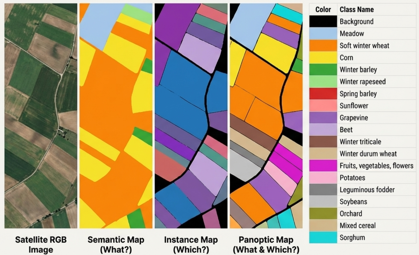
Semantic & Panoptic Understanding
We don't just classify a whole image. The network generates a Semantic Map telling us what crop exists at every single pixel (e.g., Winter wheat vs. Sunflowers), and attempts instance-level spatial separation bounding individual fields.
The ultimate outcome is Panoptic Replication: a hybrid map predicting both the continuous crop class and distinct agricultural parcel boundaries simultaneously.
How to Use the System
AgroVision analyzes full-season satellite time series (4D tensors) via ConvLSTM-UNet architecture to produce fine-grained semantic 16-channel crop maps. Upload your `.npy` tensor below.
Upload Data
Provide a .npy Tensor (Time, H, W, Channels). We support both C-first and C-last formats up to 61 sequence slices.
Run Samples
Don't have a dataset? Explore inference visually using benchmark subsets from the PASTIS validation set.
Model Architecture Pipeline
A fully-convolutional 2D U-Net acts as the spatial feature extractor, which feeds sequentially into a Convolutional LSTM (ConvLSTM) cell to preserve and interpret the temporal crop growth dynamics.